


More than 25 years after the creation of a regional open space network was recommended in the SEQ 2001 Regional Plan, South East Queensland does not have a regional park system or any coordinated network of recreational open space worth the name. The narrative of what-might-have-been is a story of opportunities lost, at least three times over.
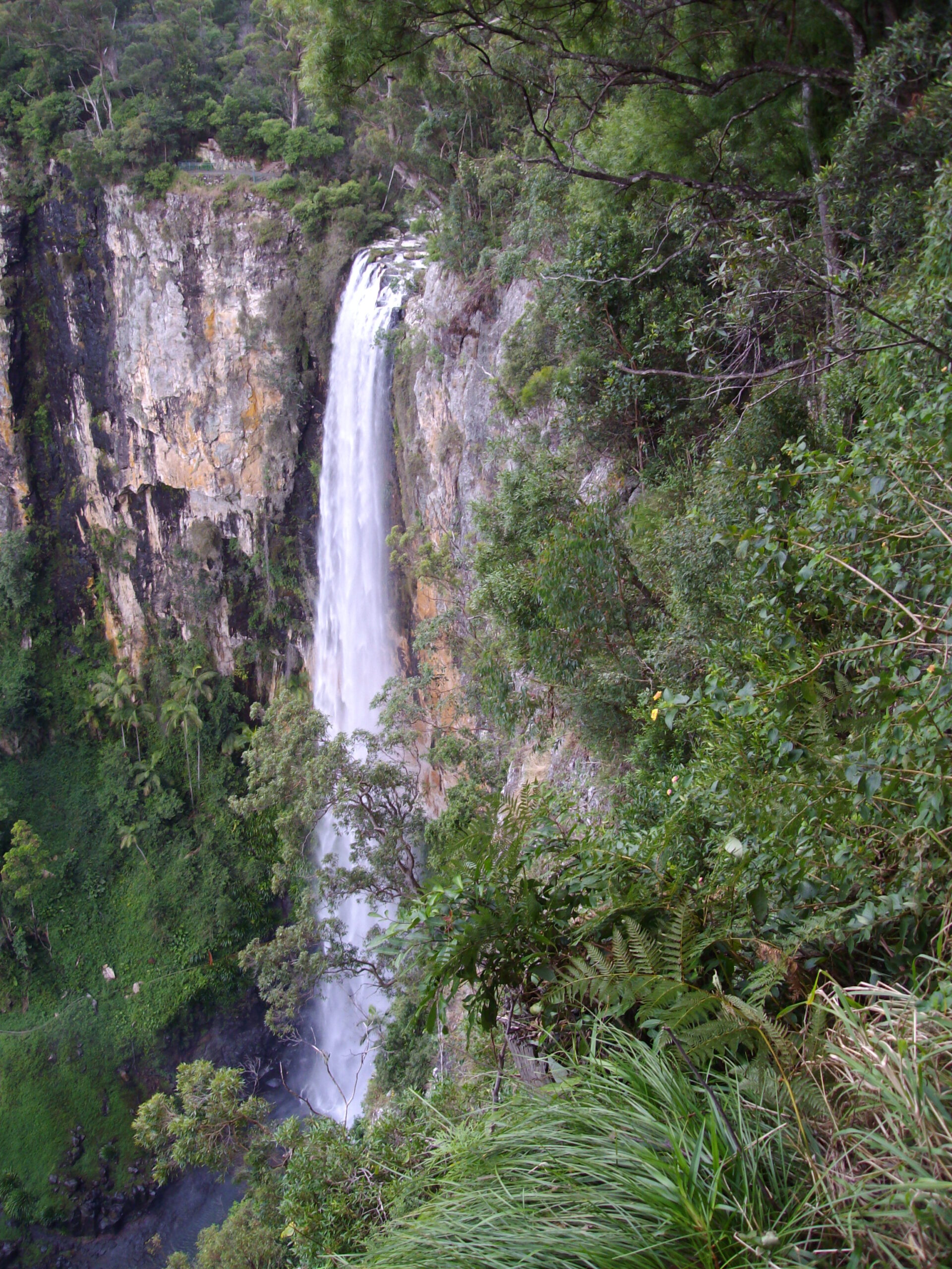 Purlingbrook Falls adjacent to the rainforest purchased under ROSS in 1994 – G. Edwards
The Regional Open Space System 1994-1998
In 1993, the South East Queensland Regional Planning Advisory Group of the SEQ2001 planning initiative recommended that a Regional Open Space System be established in South East Queensland. Academic Darryl Low Choy chaired the relevant working group which first drafted the proposal. The Department of Lands picked out regional open space from among the dozen or so policy papers produced by the SEQ2001 initiative and convened an interdepartmental committee to prepare a submission to Cabinet. The proposal was approved by Cabinet on 11 April 1994 (Submission 3483).
The Goss Government announced in the 1994/95 Budget Papers that as part of the implementation of the SEQ 2001 regional planning program, $35 million would be provided over five years, to preserve adequate areas of open space to maintain recreational, environmental and aesthetic values and the liveability of the region. This was a response to growth pressures by providing open space for recreation and other purposes including a separation of the Brisbane, Gold Coast and Sunshine Coast.
The scheme – the Regional Open Space System or ROSS – was launched by Premier Wayne Goss on 30 May 1994 and came into operation with the new financial year on 1 July. The program was administered by the Land Planning Branch of the then Department of Lands.
The proposal suggested that the ROSS would eventually cover about 21 percent of SEQ – about 12 percent then-current public land, 2 percent by voluntary acquisition and about 7 percent by management and covenants agreements with landholders. The acquisition budget was anticipated to be refreshed after the first five years, to eventually 20 years.
During the foundation year 1994/95, the Department spent the year’s allocated funds on a major mapping program, disbursements to local governments for parkland development, assistance to local governments to reflect open space in planning schemes, commissioning inventories of heritage and other features, and on land acquisition. Terms of reference for the program were approved in November 1994. (The sentence highlighted in yellow in the Appendix is the contentious definition that sank the ROSS in 1995 – it was contrary to the definition published in May 1994. The May 1994 leaflet was pulped before bulk distribution).
The first major purchase was of a missing jigsaw property in the catchment of Ewen Maddock Dam on the Sunshine Coast, with the cost shared by Caloundra Council. The $4m per annum allocated for land acquisition was supposed to be matched by local government, but the matching did not happen in a very transparent way. Only two properties were jointly paid for by councils. The major purchases ($2.4m, $1.8m, $600,000 etc) being of regional scale outweighed the capacity of the individual local governments to match them.
After some 12 properties were purchased, including the extensive pine plantations on Bribie Island, 1000 ha of rainforest and grazing land at Springbrook and a working cattle property of 15,000 ha in the mountains south of Gatton, the scheme was folded into regional planning for growth management. In June 1995, the ROSS lead agency was transferred to the then Department of Housing, Local Government and Planning and the parkland acquisition and development component ceased. See the cut-off date in the list of purchases. The transfer of lead agency was scarcely visible to the public but reflected intense negotiations within the government.
A Statement of the Role Played by the Department of Lands during its period of lead agency 1994-1995:The Foundation Year is an internal report compiled by the Department of Lands shortly after the transfer and itemising these steps taken to establish the ROSS and the achievements during that first 12 months. This report has fallen off a truck into PaRC’s hands and has not previously been publicly released. Its cut-off date is June 1995 so it does not include an explanation of what went wrong late in that first year. What happened? Similarly, two unsigned, internal summaries of the financial situation as at May 2003 and September 2003 have fallen into PaRC’s hands.
Two major limbs
The ROSS had four major limbs, with the contentious limbs highlighted:
- park voluntary acquisition, a new program
- park and recreation development, mainly via local governments, a new program
- mapping and information-gathering by departments
- statutory development control through existing planning schemes – no new program (but better mapping).
Reasons for opposition: Conflating purchase versus regulation
The conservative Opposition and the rural sector generally had no objection to voluntary acquisition of rural land for public park purposes, the first component. However, for reasons internal to the public service that have never been publicly explained, the distinction between these two methods of protecting open space became blurred. Without public consultation, maps were published showing some 50% of SEQ – covered by statutory landscape-type zonings – as being within the area of the ROSS and this was assumed by rural landholders to refer to acquisition and/or public access and so was infringement of their sovereignty. Worse, the proposal seemed to contradict the Premier’s earlier promise that no private land would be included in the system without the landholder’s consent.
The Queensland Farmers’ Federation stoked the opposition which was so painful for the government that the secretariat was passed from the Lands portfolio to then Planning Minister Terry Mackenroth, who thereafter maintained staunch opposition to any funded regional open space network, even after he left that portfolio and became Treasurer in 2001.
The collapse of the ROSS in 1996-98 in its original form was a political disaster for the government of the day.
The Coalition came into government in 1996 and the ROSS program was not continued in the original form. That Government, together with SEQ Regional Organisation of Councils, undertook a review of the program. The program was subsequently re-endorsed, re-named the “Regional Landscape Strategy” but with greatly reduced funding, and administered through the then Department of Natural Resources. A broadly based Regional Landscape Strategy Advisory Committee was established to oversee implementation. Membership included representatives of community groups, local government and State agencies.
Prior to the 2001 State election, the Government made a commitment to expand the SEQ Regional Landscape Strategy into a State-wide program. The program was transferred to the Environmental Protection Agency as part of machinery-of-Government changes made following the 2001 election, but the rollout didn’t happen.
The 2003 campaign
During 2003, a campaign promoted by the Brisbane Institute and The Courier-Mail about the inadequacy of open space in SEQ and lack of adequate regional-scale development control led to the establishment of the Office of Urban Management and ultimately the SEQ Regional Plan and SEQ Infrastructure Plan and Program. These measures addressed the second of the campaign’s concerns, growth management, but not the first, the inadequacy of public open space and lack of public parks of regional scale in the emerging growth areas, such as the Ripley corridor.
In 2005 the open space stakeholders’ committee of the Office of Urban Management proposed a program of “environmental infrastructure”. Major cost-benefits were shown in the protection of the lungs and water catchments of the city. There is some evidence that clean drinking water is the most valuable commodity that can be produced from some of the catchment areas. Expectations were high that this would lead to a major initiative in the revision of the SEQ Infrastructure Plan released in May 2006. No such program appeared.
In 2004 the Regional Landscape unit was restructured into the “Resource and Landscape Planning” branch of the planning portfolio.
Over the following eight years, the group successfully envisioned, researched, developed and, in some cases, implemented significant policies, frameworks, strategies, action plans and reports in the resource and landscape planning and open space arenas. In its work it was guided by the Regional Landscape & Open Space Advisory Committee including stakeholders across government and industry.
A summary of the group’s achievements and the recognitions it received from external parties is evidence of a continuing acknowledged need.

The 2012 abolition
Then in 2012, even regional planning for growth management was disrupted when the departmental unit responsible was abruptly disbanded. The function was reinstated after the government changed in 2015, but momentum for parkland acquisition had been lost.
Document archive
See separate page for additional documents.
In 2021…
As at 2021, the primary method of securing public parkland for the burgeoning population in SEQ is surrender by developers of small parcels at the time of subdivision. There is no coordinated plan for protecting the major river valleys or ridgelines, for linking parks across local government boundaries or for cost-sharing; except arguably the trails network.
Interstate parks systems demonstrate the potential that could be achieved. For example, after the initial acquisitions, Sydney’s fund became self-sustaining through sales of marginal properties as growth advanced. Melbourne’s metropolitan parks system includes bike ways and walkways, demonstration cattle properties, children’s farms, a public access orchard, large-group picnic grounds and heritage homesteads.
In SEQ a parks acquisition program could deliver major benefits to water quality as it would allow space for construction of wetlands and other soft-engineering works to capture stormwater. Continuous walkways could get bicycles and pedestrians off the roads. The GlenRock property as a working cattle property could become a demonstration landcare site for farmers and educational institutions. Purchase of the Meriden sand deposits between the Bruce Highway and Caloundra now in fragmented ownerships would not only allow orderly extraction resulting in the creation of wetlands (and perhaps some housing) in its wake, but would supply cheap sand for transport infrastructure purposes and would pay for itself many times over in fiscal terms alone.
But memories of a botched program linger and suffocate progress, more than 25 years later.